I have been to Ireland before, but only in the bigger cities on both coasts: Dublin and Galway. It had remained a dream to get off the beaten path into the countryside. However, I did not intend, after picking up a rental car from the Dublin airport, to drive on the country's most dangerous road. We only found out upon our arrival in Derry that we had put our lives at risk on the way to Northern Ireland.
Per our B&B proprietor's tip, we paid tribute to our survival with our first pure Irish pint at George's Bar. With our newfound sense of mortality, we wandered within the city's walls (top left) to find another suggested spot, Tracy's Bar (top right), the first among many pubs with non-traditional music and non-understandable patrons. I was so giddy I was in one piece that I foolishly tried to order a whisky sour. Thankfully, the friendly regulars forgave me, allowing us to sing along to Paul Simon while watching soccer till we succumbed to jet lag. The Celtic hospitality continued in the morning, with a meat-heavy full Irish breakfast (bottom).
Considering Derry's connection to the start of the Troubles and as the site of Bloody Sunday, we thought we should pay respects at the City Cemetery, where many victims are laid to rest (top). We paused a moment overlooking the River Foyle before setting out for our next city. On the way, we made a detour, as directed by many folks the night before, to Grianán of Aileach (bottom left), a 1st century stone fort from whose rim you can see five counties on a clear day, which it was not (bottom right). Still, the view was amazing, but not as good as the vista in Glenveagh National Park, where we stopped to take a hike (top). From the Old Dunlewey Church, we delved into Poisoned Glen, bisecting the bog in the mountain basin without spying another soul (middle left). It wasn't until we double-backed to the trailhead bridge that we saw signs of human life (middle right). It got wet as we continued on the Wild Atlantic Way, and the drops were really coming down by the time we checked into our room in Donegal (bottom left). We hunkered down out of the rain at The Reveller Bar, where we senselessly played pool on a snooker table (bottom right) and the bartender schooled us in the differences between American and Gaelic football.
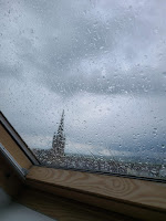
With a bit of Irish luck, our next day out and about in county Donegal was mostly dry. It was still a little damp when I took a morning stroll along the town's River Bank Walk (top left). But by the time we pulled off the road to see Assaranca Waterfall, the only H20 in the air was mist from the cascade (top right). And by the time we hit Maghera Beach just around the bend, we could even spy slivers of blue sky (bottom). Because it was low tide, we could explore the strand's many slot caves (top left). The positioning of life-saving rings and the waterline on the stratified-stone walls clearly showed that the sea level could have been well above our heads without proper planning (top right). We stopped by Slieve League Cliffs on our way back to town (bottom left), but about halfway up to the trail summit, dark clouds became downpours, so we called it a day. I shook off the showers with a shellfish pasta at Olde Castle Seafood Bar (bottom right), then we spent the night sheltered from storms at McCafferty's, a good spot for IPAs and footie.
Since our next stop wasn't far away, the next morning we had a leisurely breakfast before setting out for Sligo. The avocado toast at Blueberry Tea Room was more American but still just as abundant as a traditional Irish breakfast (top left). Upon a recommendation from our friendly footballer bartender, we made a quick stop at Rossnowlagh Beach, a renown surfing beach (top right). No one was in the water, probably because of low tide, but the grooves blown into the sand indicated conditions favorable to hang-ten crests. We didn't try any water sports, but we braved the land sport of Irish driving as we navigated the narrow but luckily vacant roads of the Gleniff Horseshoe (bottom left). We could triangulate where we were on the 10K loop by our position in relation to Benwisken (bottom right), a mountain in the Daltry range along with the more famous, although arguably less visually distinct, Benbulben.
Our weather-app radar showed rain on the way, so we slid on into Sligo. While downing some delicious pizza at Swagman (top left), we noticed a surprising sign amid the whisky (top right). Apparently, a brewer at The White Hag, a local craft producer, hailed from central Ohio and fell in with the bar's owner. We toasted their friendship with a few beers from the best tap selection we saw in Ireland, then we checked into our room in the surfing suburb of Strandhill (bottom left). Later, we strolled among the dunes behind The Strand Bar (bottom right), where we had a quick drink before heading back downtown for livelier environs.
We lounged with locals at the curiously named Shoot the Crows (left), then I raised my first Guinness pint to salute the musical duo at Thomas Connolly's (right). Our fun was deflated by some forced participation in the global sport of "retracing your steps to find your rental-car keys" -- that were in your dashboard console all along. And thus, the first half of our trip ended with gratitude for the kindness of helpful strangers and relief for the blessing of an unstolen vehicle.
------
Lennox, P. J. “The Historical Aspect of Home Rule.” The North American Review, vol. 195, no. 679, 1912, pp. 788–802. JSTOR, http://www.jstor.org/stable/25119775. Accessed 5 Aug. 2024.


No comments:
Post a Comment